2024 Mt. Hood Daze
2 days of orienteering near Mt. Hood and the Columbia River Gorge
Registration is closed as we have reached our participant limit. PARTICIPANTS/START TIMES
For more event details, including lodging recommendations, see the latest bulletin, which you can print and bring to the event (internet and cell phone coverage is spotty or non existent at our event sites).
Bulletin 1 - Introductions to venues, detailed directions, lodging recommendations, registration information, special rules
Updated 9/27/24 - Bulletin 2 - Updated course stats! Bulletin 1 plus course stats, hazard info, start times
Welcome to the first Mt. Hood Daze event featuring a long-time favorite map of Catherine Creek, and a brand new map of the wilderness area around the Billy Bob Snow Park.
For 2024, we will focus just on the orienteering courses at these two venues without arranging for any product sales or banquet dinners.
We will provide suggestions for lodging and restaurants in our bulletins but participants need to make their own arrangements for those things. We encourage participants to join in with others while socializing after the events. There is a lot to enjoy in this Mt. Hood and Columbia River Gorge region while you rest between events.
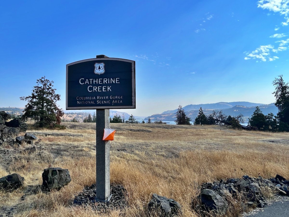
Catherine Creek regional event
The Catherine Creek map was first created around 2010 and it covers 4 square kilometers of mostly open grasslands that include occasional copses and a few mostly open forested areas. Much of this venue is a moderately sloped hillside rising above the Columbia River, but there is also a deep canyon with rocky cliffs that divides two rising portions of this parkland. The western portion of the parkland includes many smaller rocky cliffs that runners will have to decide whether to climb or go around them.
Although you can often see long distances at this venue, the topography includes many mounds, depressions, and spurs that can sometimes make it difficult to follow bearings and find controls. The southern portion of the park is more vegetated with more limited views of the land. Much of this venue is very rugged with rocky surfaces that can twist ankles--if you need ankle protection, wear it. Most of this venue has incredible views of the Columbia River Gorge.
Courses, classes, and maps (see the printable bulletins for details)
Recreational courses (white, yellow, orange, brown, green, and red)
Starts and finishes are planned to be located by the main parking area.
Catherine Creek is NOT a national ranking event (NRE) but it is a great warm up for the NRE at Billy Bob the next day.
This venue is embargoed only for 24 hours before the event while courses are being set.
Location
GPS Coordinates: 45.7105, -121.3620 (detailed directions in the bulletins)
Located across the Columbia River from the town of Hood River, OR and 7.5 miles east from White Salmon, WA.
Parking is limited. Please carpool so that you don't have to use the overflow parking located about 1 mile from the event center.
Starts are from 11 AM to 1 PM. Your start time begins when you punch the start. Courses close at 4 PM.
Staff
Director: Tony Pinkham
Course Setters: Jill/Rick McBee and Julie Pohl
Vetters: TBD
Billy Bob National Ranking Event (NRE)
The open forest and scattered trees of the Billy Bob area, Mt. Hood National Forest
The Billy Bob map was created in August of 2024 for this event and it covers 6 square kilometers of US Forest Service land at 1100 to 1500 meters of elevation. This area is mostly open forest and scattered trees, but there are mapped denser vegetation patches and tree fall areas that are marked as dark green/fight and are best avoided. The area includes many prominent point features (including some large rocky features) that can be used for navigation.
The mapper, Yves Nager, felt that the western portion of this map has some of the most technical yet runnable terrain that he has mapped in three decades of mapping. Fortunately, if you get lost or disoriented, you'll find that there are forest roads bordering the northern, western, and southern edges of the map. A scout camp borders much of the eastern portion.
Classes, courses, and maps (see the printable bulletins for details)
Billy Bob national ranking and recreational event
Standard Orienteering USA competitive gender-age classes for individuals wanting national ranking
Open color classes for individuals wanting national ranking on the course of their choice (not determined by their age)
Recreational classes (rec-white, rec-yellow, rec-orange, rec-brown, and rec-green) for individuals or groups wanting to orienteer on their choice of courses without national ranking
Starts will probably be remotely located
Finishes Will probably be located by the main parking area
This venue is embargoed until the event occurs
Location
GPS Coordinates: 45.4038, -121.4517 (detailed directions in the bulletins)
Located 26 miles south of Hood River, OR and then 10 miles east of Hwy 35.
Parking is limited. Please carpool.
Starts are from 11 am to 1 pm. Your start time begins when you punch the start. Courses close at 4 pm. Participants who change their start time or not guaranteed a full three hours to do their course.
Staff
Director: Tony Pinkham
Course Setters: Alison Crocker and Mike Bruns
Vetters: John Crowther
OUSA Course Consultant: David Tallent
Registration begins in mid August. Late registration (and higher fees) occur from Sept 6 to Sept 24. All registration is online and there will be no registration at the event.
To see who has registered, click here
Volunteering opportunities abound for our event-day functions, such as event center setup, check in, starts, parking control, and control pickup. Let us know if you can help. Thank you!
Lodging can be found at various hotels near Hood River, OR; Government Camp, OR; and White Salmon, WA as well as at various campsites in the region. See the bulletins for more details.
Questions? Email either Registration or the Event Director
A rocky outcrop on the Billy Bob map, Mt Hood National Forest


